

Molas Shipwreck
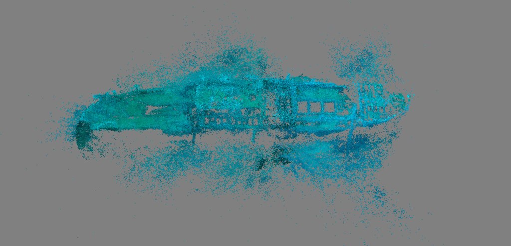

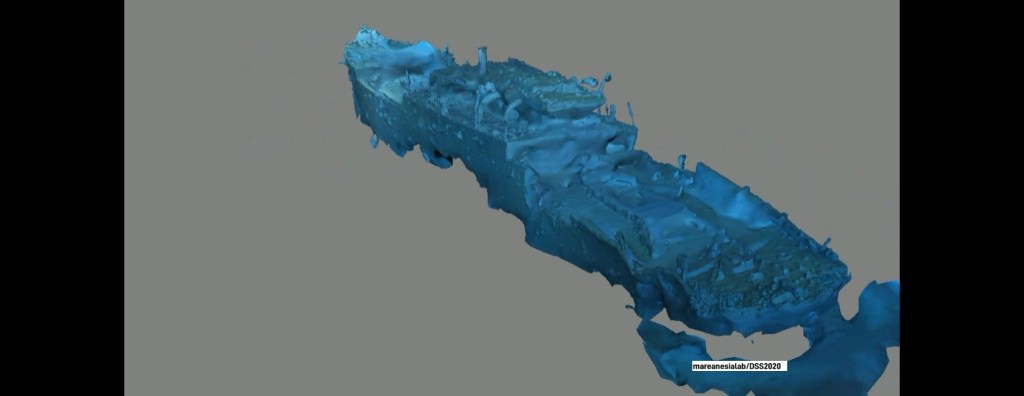
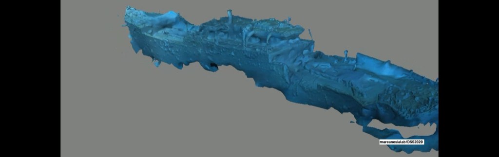
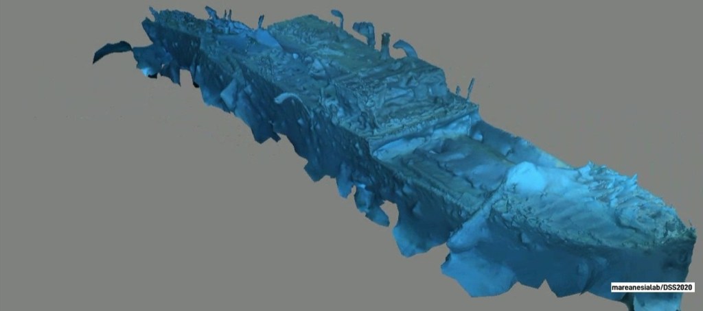


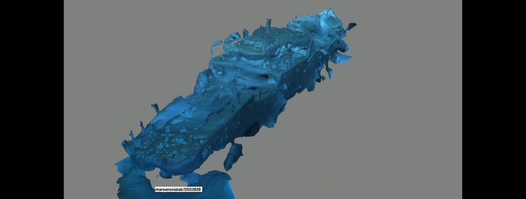
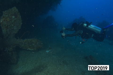
Molas Shipwreck; has been recorded on navigation charts during the colonial period with the Netherland Code 62. – NM 1843/54. H4807/54, 7.2.62 – (Hague NM 109/1523/56; 013004N, 1244945E. Furthermore, in 1954, the UKHI navigation chart with the code H4807/54, 24-8-54 position seen from Manado [012930N, 1245005E] was estimated at: (a) 345DEGS, 3800FT; (b) 41DEGS, 3280FT; (c) 322DEGS, 2490FT; (d) 277DEGS, 1510FT; (e) 275DEGS, 2720FT. On the marine navigation chart, the existence of this sunken ship is categorized as Obstruction. It is suspected that this ship is the Thorbecke. Now the sunken ship is slowly constructing its identity in common-sense & curation of recreational and hobbyist diving beyond interest-an awareness in the North Sulawesi region, at least that’s what the entities there are doing.
Pontoon Bridge Bengawan Solo
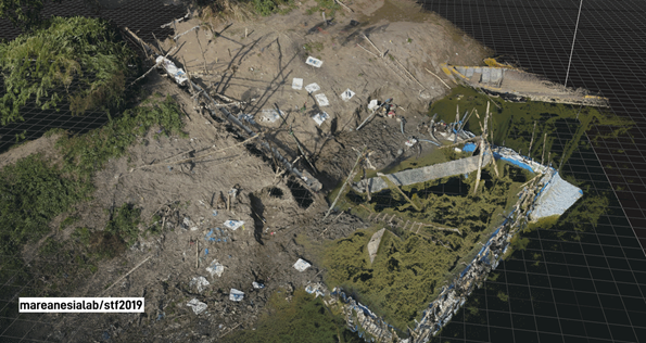
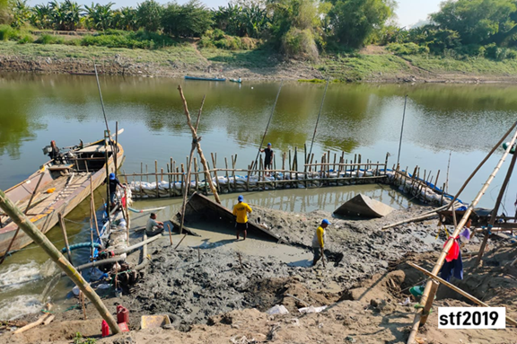

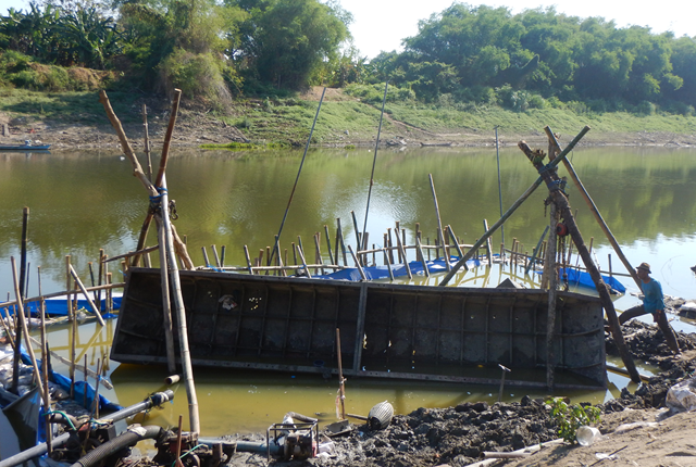
The rumor that the objects/structures are colonial-era warships sailing on the Bengawan Solo is speculation and a fallacy in research. Research; researching uses the basic word “search”!. The fact is that the object is a Pontoon bridge, not a ship, which is commonly used in the military world. That the structure is a colonial era that is connected to the conflict period in the World War II era. The MEB code explains clearly that the pontoon bridge is a structure that is arranged modularly as a structure to support military activities.
